


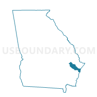
1791 - RICEBORO Voting District, Liberty County, Georgia
About
Outline

Summary
| Unique Area Identifier | 562371 |
| Name | 1791 - RICEBORO Voting District |
| County | Liberty County |
| State | Georgia |
| Area (square miles) | 99.22 |
| Land Area (square miles) | 89.25 |
| Water Area (square miles) | 9.97 |
| % of Land Area | 89.95 |
| % of Water Area | 10.05 |
| Latitude of the Internal Point | 31.71118020 |
| Longtitude of the Internal Point | -81.40250150 |
Maps


Graphs
Select a template below for downloading or customizing gragh for 1791 - RICEBORO Voting District, Liberty County, Georgia


Neighbors
Neighoring Voting District (by Name) Neighboring Voting District on the Map
- 17914 - TOWN OF ALLENHURST Voting District, Liberty County, GA
- 1793 - DORCHESTER Voting District, Liberty County, GA
- 1795 - FLEMING WEST Voting District, Liberty County, GA
- 1835 - TIBET Voting District, Long County, GA
- 1911480 - TOWNSEND Voting District, McIntosh County, GA
- 19122 - SOUTH NEWPORT Voting District, McIntosh County, GA
Top 10 Neighboring County Subdivision (by Population) Neighboring County Subdivision on the Map
- Hinesville CCD, Liberty County, GA (52,662)
- Midway CCD, Liberty County, GA (8,911)
- Ludowici South CCD, Long County, GA (5,598)
- Townsend CCD, McIntosh County, GA (4,432)
- Riceboro CCD, Liberty County, GA (1,880)
Top 10 Neighboring Place (by Population) Neighboring Place on the Map
Top 10 Neighboring Unified School District (by Population) Neighboring Unified School District on the Map
- Liberty County School District, GA (54,069)
- Long County School District, GA (14,464)
- Mcintosh County School District, GA (14,333)
Top 10 Neighboring State Legislative District Lower Chamber (by Population) Neighboring State Legislative District Lower Chamber on the Map
Top 10 Neighboring State Legislative District Upper Chamber (by Population) Neighboring State Legislative District Upper Chamber on the Map
- State Senate District 1, GA (184,711)
- State Senate District 3, GA (175,054)
- State Senate District 19, GA (161,882)
Top 10 Neighboring 111th Congressional District (by Population) Neighboring 111th Congressional District on the Map
Top 10 Neighboring Census Tract (by Population) Neighboring Census Tract on the Map
- Census Tract 104, Liberty County, GA (7,278)
- Census Tract 9702, Long County, GA (5,598)
- Census Tract 105.02, Liberty County, GA (5,109)
- Census Tract 1101, McIntosh County, GA (4,432)
- Census Tract 105.01, Liberty County, GA (3,802)
- Census Tract 102.04, Liberty County, GA (3,252)
- Census Tract 106, Liberty County, GA (1,880)